
WIKIARCHIVES.SPACE
The Human Spaceflight Archive
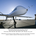
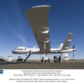
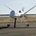
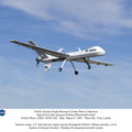
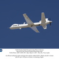
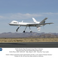
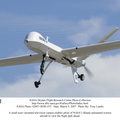
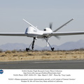
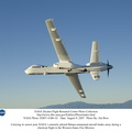
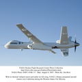
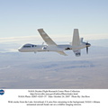
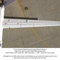
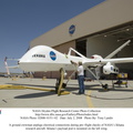
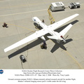
NASA and the U.S. Forest Service are testing newly developed technologies to improve wildfire imaging and mapping capabilities ion the Western States Fire Mission. From mid-August through September, 2007, NASA's Dryden Flight Research Center flew its remotely piloted Ikhana, a General Atomics Aeronautical Systems Predator B unmanned aircraft system adapted to civil missions, in a series of missions to demonstrate the capabilities of sophisticated new thermal-infrared imaging sensors and real-time data communications equipment developed at NASA's Ames Research Center. The sensor is capable of peering through thick smoke and haze to record hot spots and the progression of wildfires over a lengthy period.


Information
- Taken in
- Edwards Air Force Base
- Author
- NASA
- Description
-
NASA and the U.S. Forest Service are testing newly developed technologies to improve wildfire imaging and mapping capabilities ion the Western States Fire Mission. From mid-August through September, 2007, NASA's Dryden Flight Research Center flew its remotely piloted Ikhana, a General Atomics Aeronautical Systems Predator B unmanned aircraft system adapted to civil missions, in a series of missions to demonstrate the capabilities of sophisticated new thermal-infrared imaging sensors and real-time data communications equipment developed at NASA's Ames Research Center. The sensor is capable of peering through thick smoke and haze to record hot spots and the progression of wildfires over a lengthy period.
The first flight of the series Aug. 16, 2007 captured images of California wildfires, including the huge Zaca Fire in Santa Barbara and Ventura Counties. Other flights in the series were to take the aircraft to image wildfires burning in the Pacific Northwest during missions lasting more than 20 hours. The data is overlaid on Google Earth maps and downlinked in near-real time to the Interagency Fire Center in Boise, Idaho, and made available to fire incident commanders to assist them in allocating their fire-fighting resources.
- Created on
- Thursday 9 August 2007
- Albums
- US SPACE PROGRAM / AERONAUTICS RESEARCH / IKHANA
- Source link
- https://www.dfrc.nasa.gov/Gallery/Photo/Ikhana/index.html
- Visits
- 21
Location : 34.954046, -117.873320
- Rating score
- no rate
- Rate this photo
- License
- Public Domain
- Modified by WikiArchives
- No (original)
- Downloads
- 0
Powered by Piwigo