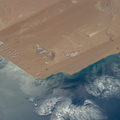
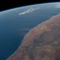
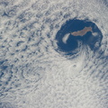
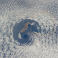
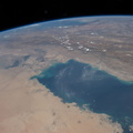
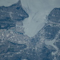
 in westernmost Iran. The lake is highly saline and only a few tens of meters deep even at high. The shoreline appears as a white margin of salt. Rivers that flow into the lake appear as narrow green lines (especially on the southeastern lake margin; top right), and these form deltas where soft soils and a nearby water supply allow farming, areas marked by clusters of green agricultural fields. The lake and its wetlands have been declared a UNESCO Biosphere. The lake is one of the largest in the Middle East, measuring 130 kilometers from the northern shoreline to the vegetated delta image right. The city of Urmia stands out as a distinct gray patch surrounded by fields at lower left. On the opposite shore from the city an extinct volcano appears as an oval shape. A causeway and bridge connect the opposite shorelines at this point. More detailed images of the causeway can be seen here. The lake is experiencing a drastic loss of water, and now holds only approximately five percent of its known high-stage volume. The drying is vividly illustrated by the fact that the volcano used to be entirely surrounded by the lake. Observers say the cause of the drop in water levels is related to extraction of water for farming and a long-term decrease in rainfall.")
WIKIARCHIVES.SPACE
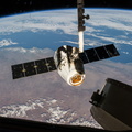
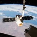
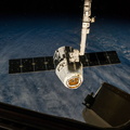
The Human Spaceflight Archive


Information
- Taken in
- Space
- Author
- NASA
- Description
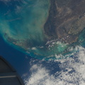
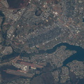
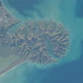
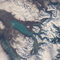
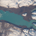
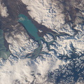
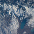
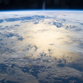
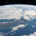
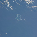
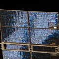
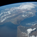
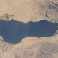
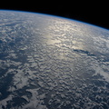
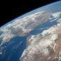
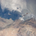
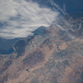
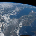
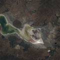
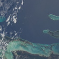
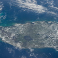
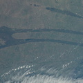
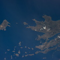
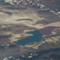
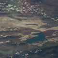
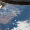
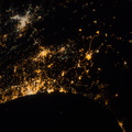
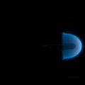
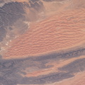
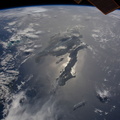
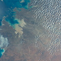
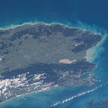
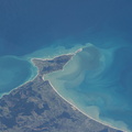
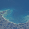
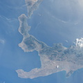
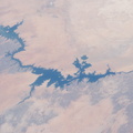
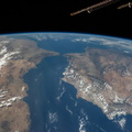
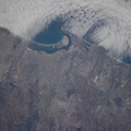
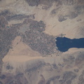
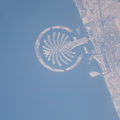
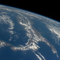
- Lake Urmia, Iran is featured in this image photographed by an Expedition 40 crew member on the International Space Station. Green and tan shades show the extent of the water surface of Lake Urmia (also Orumiyeh, Orumieh) in westernmost Iran. The lake is highly saline and only a few tens of meters deep even at high. The shoreline appears as a white margin of salt. Rivers that flow into the lake appear as narrow green lines (especially on the southeastern lake margin; top right), and these form deltas where soft soils and a nearby water supply allow farming, areas marked by clusters of green agricultural fields. The lake and its wetlands have been declared a UNESCO Biosphere. The lake is one of the largest in the Middle East, measuring 130 kilometers from the northern shoreline to the vegetated delta image right. The city of Urmia stands out as a distinct gray patch surrounded by fields at lower left. On the opposite shore from the city an extinct volcano appears as an oval shape. A causeway and bridge connect the opposite shorelines at this point. More detailed images of the causeway can be seen here. The lake is experiencing a drastic loss of water, and now holds only approximately five percent of its known high-stage volume. The drying is vividly illustrated by the fact that the volcano used to be entirely surrounded by the lake. Observers say the cause of the drop in water levels is related to extraction of water for farming and a long-term decrease in rainfall.
- Created on
- Monday 23 June 2014
- Albums
- ISS (WIP) / EXPEDITIONS / EXPEDITION 40
- Source link
- https://www.flickr.com/photos/nasa2explore/albums/72157631560566351/
- Visits
- 71
- Rating score
- no rate
- Rate this photo
- License
- CC BY-NC-ND
- Modified by WikiArchives
- No (original)
- Downloads
- 1
EXIF Metadata
NIKON CORPORATION NIKON D3S
- Make
- NIKON CORPORATION
- Model
- NIKON D3S
- DateTimeOriginal
- 2014:06:23 09:55:25
- ApertureFNumber
- f/16.0
Powered by Piwigo