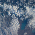
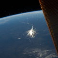
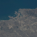
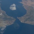
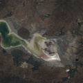
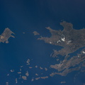
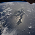
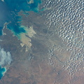
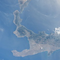
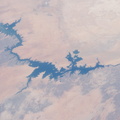
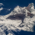
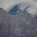
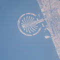
 volcano which last erupted in 1860, according to NASA scientists studying the space station imagery.")
WIKIARCHIVES.SPACE
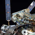
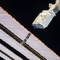
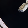
The Human Spaceflight Archive


Information
- Taken in
- Space
- Author
- NASA
- Description
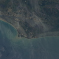
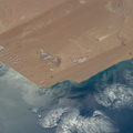
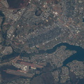
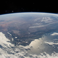
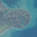
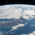
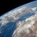
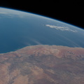
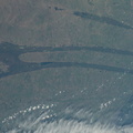
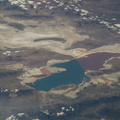
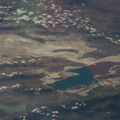
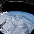
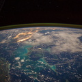
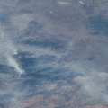
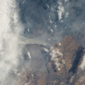
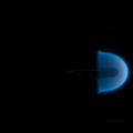
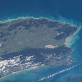
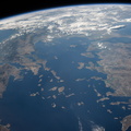
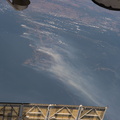
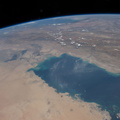
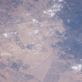
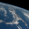
- One of the Expedition 40 crew members aboard the International Space Station recorded this nearly vertical image of the Taranaki region on the west coast of New Zealand's North Island on May 31, 2014. Just above left center in the frame is Mount Egmont, an 8,261-ft. high (2,518 meters) volcano which last erupted in 1860, according to NASA scientists studying the space station imagery.
- Created on
- Saturday 31 May 2014
- Albums
- ISS (WIP) / EXPEDITIONS / EXPEDITION 40
- Source link
- https://www.flickr.com/photos/nasa2explore/albums/72157631560566351/
- Visits
- 73
- Rating score
- no rate
- Rate this photo
- License
- CC BY-NC-ND
- Modified by WikiArchives
- No (original)
- Downloads
- 0
EXIF Metadata
NIKON CORPORATION NIKON D3S
- Make
- NIKON CORPORATION
- Model
- NIKON D3S
- DateTimeOriginal
- 2014:05:31 22:56:26
- ApertureFNumber
- f/9.0
Powered by Piwigo