 with a 70mm Hasselblad camera using high-definition aerial Ektachrome SO-242 type film.")
WIKIARCHIVES.SPACE
The Human Spaceflight Archive


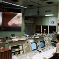


Information
- Taken in
- Space
- Author
- NASA
- Description
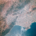
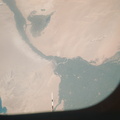
- A near vertical view of the most southerly portion of the Island of Sicily in the Mediterranean Sea, as photographed from the Apollo spacecraft in Earth orbit during the joint U.S.-USSR Apollo-Soyuz Test Project mission. This view includes the towns of Gala, Pachino, Avela and Pozzalo. The photograph was taken at an altitude of 228 kilometers (141 statute miles) with a 70mm Hasselblad camera using high-definition aerial Ektachrome SO-242 type film.
- Created on
- Sunday 20 July 1975
- Albums
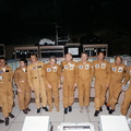
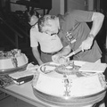
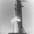
- US SPACE PROGRAM / APOLLO / APOLLO SOYUZ ASTP / Mission Photos (Edited)
- Source link
- https://www.flickr.com/photos/nasa2explore/9363122545/in/album-72157634792711526/
- Visits
- 69
- Rating score
- no rate
- Rate this photo
- License
- CC BY-NC
- Modified by WikiArchives
- No (original)
- Downloads
- 1
Powered by Piwigo