WIKIARCHIVES.SPACE
The Human Spaceflight Archive

Information
- Taken in
- Space
- Author
- NASA
- Description
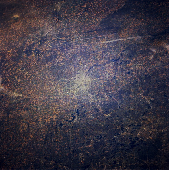
- Viewing south to north, this panoramic, north-looking, low-oblique photograph features several cities—Pontiac (lower right); Flint (near center), a chief automobile manufacturing center on the Flint River; Saginaw, a rich agricultural area on the Saginaw River 15 miles (24 kilometers) south of Saginaw Bay; and Bay City (left of upper center), which lies at the mouth of the Saginaw River that enters Saginaw Bay, an inlet of Lake Huron (not visible). Bay City is the industrial, marketing, and shipping center of a rich farm area, and its harbors handle considerable Great Lakes and ocean shipping. Both Bay City and Saginaw are rich in Indian relics.
- Created on
- Albums
- US SPACE PROGRAM / SPACE SHUTTLE / MISSIONS / STS-66 / Mission Photos (Edited)
- Source link
- https://www.flickr.com/photos/nasa2explore/9390733199/in/album-72157634846480872/
- Visits
- 49
- Rating score
- no rate
- Rate this photo
- License
- CC BY-NC
- Modified by WikiArchives
- No (original)
- Downloads
- 0
Powered by Piwigo


