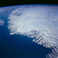
 above sea level. The more rugged Mahabharat Range has peaks and ridge lines that exceed 7000 feet (2130 meters) above sea level (northern edge of the photograph).")
WIKIARCHIVES.SPACE
The Human Spaceflight Archive


Information
- Taken in
- Space
- Author
- NASA
- Description
- The alluvial fan created by the deposition of sediment from the Arun River and its tributaries as it breaks out of the foothills of the Himalaya Mountains is highlighted in this near-vertical, color infrared photograph. The white features are extensive sandbars along some of the riverbeds in southeastern Nepal. Part of the floodplain is emphasized by the linear levees that surround part of the river northeast of Hanumannagar, a small town near the Indian boarder. The thin, dark lines east of the river are part of a canal system that services part of southeastern Nepal and north-central India. The deep reds on the hills and low mountains document healthy growth of green vegetation in this part of Nepal—a special interest to environmentalists since deforestation is one of Nepal’s major environmental threats. The low, vegetated Churia Ghati Hills, west of the Arun River, reach approximately 1000 feet (305 meters) above sea level. The more rugged Mahabharat Range has peaks and ridge lines that exceed 7000 feet (2130 meters) above sea level (northern edge of the photograph).
- Created on
- Albums
- US SPACE PROGRAM / SPACE SHUTTLE / MISSIONS / STS-66 / Mission Photos (Edited)
- Source link
- https://www.flickr.com/photos/nasa2explore/9393512468/in/album-72157634846480872/
- Visits
- 61
- Rating score
- no rate
- Rate this photo
- License
- CC BY-NC
- Modified by WikiArchives
- No (original)
- Downloads
- 0
Powered by Piwigo