 is visible as the water flow enters the northeast side of Corella Lake (rectangular-shaped whitish feature—nearest top of image). The Burnette Creek channel (narrow, dark linear feature) can be traced southwesterly across the grasslands as the creek enters Lake Sylvester (roughly oval-shaped feature nearest right side of the picture). The other two milky colored features (largest and smallest in area) are also shallow lakes that have been created by the overflow from Corella Lake and Lake Sylvester. In wetter years these lakes can be connected by narrow channels. It is interesting to note that the outline of these lakes and their drainage pattern does not directly correlate to existing maps. The grasslands found in this sparsely populated environment support some pastoral grazing.")
WIKIARCHIVES.SPACE
The Human Spaceflight Archive


Information
- Taken in
- Space
- Autor
- NASA
- Descrição
- Four sizable, highly reflective surfaces are milky colored freshwater lakes that are located on the Barkly Tablelands. The surface inflow of fresh water is primarily from two different sources. A section of the Corella Creek and its swampy delta (darker landscape) is visible as the water flow enters the northeast side of Corella Lake (rectangular-shaped whitish feature—nearest top of image). The Burnette Creek channel (narrow, dark linear feature) can be traced southwesterly across the grasslands as the creek enters Lake Sylvester (roughly oval-shaped feature nearest right side of the picture). The other two milky colored features (largest and smallest in area) are also shallow lakes that have been created by the overflow from Corella Lake and Lake Sylvester. In wetter years these lakes can be connected by narrow channels. It is interesting to note that the outline of these lakes and their drainage pattern does not directly correlate to existing maps. The grasslands found in this sparsely populated environment support some pastoral grazing.
- Created on
- Álbuns
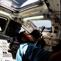
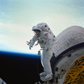
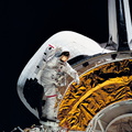
- US SPACE PROGRAM / SPACE SHUTTLE / MISSIONS / STS-51 / Mission Photos (Edited)
- Source link
- https://www.flickr.com/photos/nasa2explore/9359281859/in/album-72157634784994098/
- Visitas
- 41
- Avaliação
- nenhuma nota
- Dê uma nota a esta imagem
- License
- CC BY-NC
- Modified by WikiArchives
- No (original)
- Downloads
- 0
Powered by Piwigo