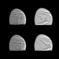
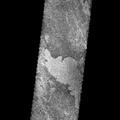
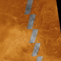
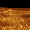
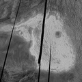
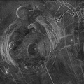
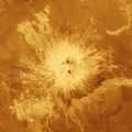
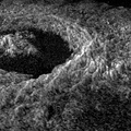
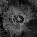
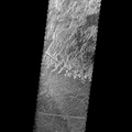
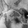
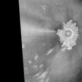
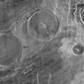
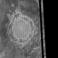
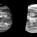
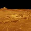
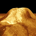
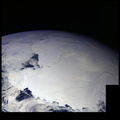
 diameter impact crater located at about 60.5 degrees north latitude, 287.2 degrees east longitude, contains Magellan data mosaiced with a Soviet Venera 15/16 radar image of the same feature. The Magellan part of the image (right) reveals details of the geology of the crater such as the central peak, the inner terraced walls, and the extremely smooth floor of the crater. The smoothness of the floor may be due to pounding of volcanic lava flows in the crater floor. The rough, blocky morphology of the crater ejecta and the sharp terraced crater wall suggest that this feature is relatively young. The Soviet data have a resolution of 102 km (0.601.2 miles); the Magellan data have a resolution of about 120 meters (400 feet).")
WIKIARCHIVES.SPACE
The Human Spaceflight Archive


Information
- Auteur
- NASA/JPL-Caltech
- Description
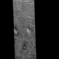
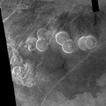
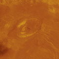
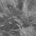
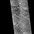
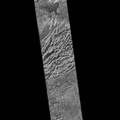
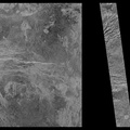
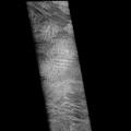
- This image of the Venusian crater Golubkina, a 340 kilometer (20.4 miles) diameter impact crater located at about 60.5 degrees north latitude, 287.2 degrees east longitude, contains Magellan data mosaiced with a Soviet Venera 15/16 radar image of the same feature. The Magellan part of the image (right) reveals details of the geology of the crater such as the central peak, the inner terraced walls, and the extremely smooth floor of the crater. The smoothness of the floor may be due to pounding of volcanic lava flows in the crater floor. The rough, blocky morphology of the crater ejecta and the sharp terraced crater wall suggest that this feature is relatively young. The Soviet data have a resolution of 102 km (0.601.2 miles); the Magellan data have a resolution of about 120 meters (400 feet).
- Créée le
- Lundi 5 Février 1996
- Albums
- US SPACE PROGRAM / PROBES / VENUS / MAGELLAN / Mission Photos (Edited)
- Source link
- https://photojournal.jpl.nasa.gov
- Visites
- 273
- Bilan
- pas de note
- Votez pour cette image
- License
- Public Domain
- Modified by WikiArchives
- No (original)
- Téléchargements
- 20
Propulsé par Piwigo