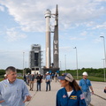
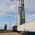
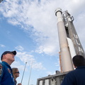
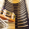
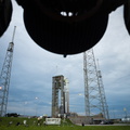
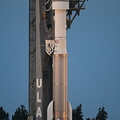
 remove the protective blankets from one payload fairing half for the Landsat 9 spacecraft on Aug. 2, 2021. The two halves of the ULA payload fairing will be secured around Landsat 9 to protect it during launch atop the ULA Atlas V rocket. Landsat 9 will launch on the Atlas V rocket from Space Launch Complex 3 at Vandenberg in September 2021. The launch is being managed by NASA’s Launch Services Program based at Kennedy Space Center, America’s multi-user spaceport. The Landsat 9 satellite will continue the nearly 50-year legacy of previous Landsat missions. It will monitor key natural and economic resources from orbit. Landsat 9 is managed by the agency’s Goddard Space Flight Center in Greenbelt, Maryland. The satellite will carry two instruments: the Operational Land Imager 2, which collects images of Earth’s landscapes in visible, near infrared and shortwave infrared light, and the Thermal Infrared Sensor 2, which measures the temperature of land surfaces. Like its predecessors, Landsat 9 is a joint mission between NASA and the U.S. Geological Survey.")
WIKIARCHIVES.SPACE
The Human Spaceflight Archive


Information
- Taken in
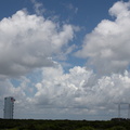
- Vandenberg
- 작성자
- NASA/Randy Beaudoin
- Description
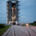
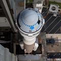
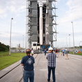
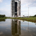
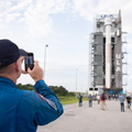
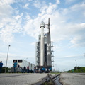
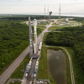
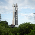
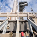
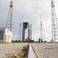
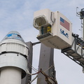
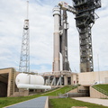
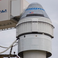
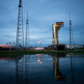
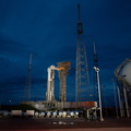
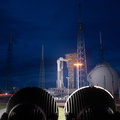
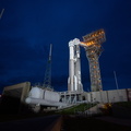
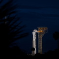
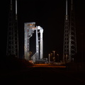
- Inside the Integrated Processing Facility at Vandenberg Space Force Base in California, technicians with United Launch Alliance (ULA) remove the protective blankets from one payload fairing half for the Landsat 9 spacecraft on Aug. 2, 2021. The two halves of the ULA payload fairing will be secured around Landsat 9 to protect it during launch atop the ULA Atlas V rocket. Landsat 9 will launch on the Atlas V rocket from Space Launch Complex 3 at Vandenberg in September 2021. The launch is being managed by NASA’s Launch Services Program based at Kennedy Space Center, America’s multi-user spaceport. The Landsat 9 satellite will continue the nearly 50-year legacy of previous Landsat missions. It will monitor key natural and economic resources from orbit. Landsat 9 is managed by the agency’s Goddard Space Flight Center in Greenbelt, Maryland. The satellite will carry two instruments: the Operational Land Imager 2, which collects images of Earth’s landscapes in visible, near infrared and shortwave infrared light, and the Thermal Infrared Sensor 2, which measures the temperature of land surfaces. Like its predecessors, Landsat 9 is a joint mission between NASA and the U.S. Geological Survey.
- 생성일
- 월요일 2 8월 2021
- 앨범
- US SPACE PROGRAM / SATELLITES / ATLAS V / LANDSAT 9 / Rocket preparation
- Source link
- https://www.flickr.com/photos/nasakennedy/albums/72157719454254597
- 방문자
- 30
- 평점
- 평점 없음
- 이 사진 평가
- License
- CC BY-NC-ND
- Modified by WikiArchives
- No (original)
- 다운로드
- 1
EXIF 메타데이터
NIKON CORPORATION NIKON D7100
- Make
- NIKON CORPORATION
- Model
- NIKON D7100
- DateTimeOriginal
- 2021:08:02 17:11:55
- ApertureFNumber
- f/6.3
Powered by Piwigo