 rather than those in other parts of Australia (i.e. more convenient and easier to see, rectilinear patterns which are prevalent in less arid areas).")
WIKIARCHIVES.SPACE
The Human Spaceflight Archive


Information
- Taken in
- Space
- Author
- NASA
- Description
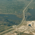
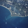
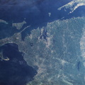
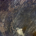
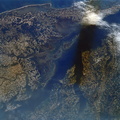
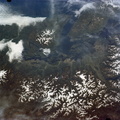
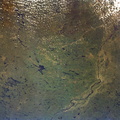
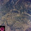
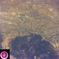
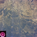
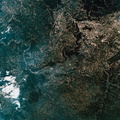
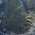
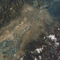
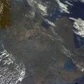
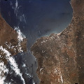
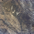
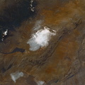
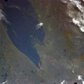
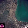
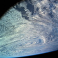
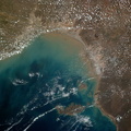
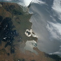
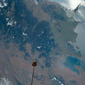
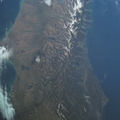
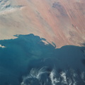
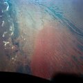
- A vertical view of a portion of the State of Queensland, Australia, as photographed from the Skylab space station in Earth orbit by one of the Skylab 4 crewmen. The camera used was a hand-held 70mm Hasselblad, with SO-368 medium speed Ektachrome film. The body of water is the southeastern part of the Gulf of Carpentaria. This picture was taken in support studies of the north Australian drought region. The largest island seen is Mornington. The town of Normanton can also be seen. Of interest here is the sediment-laden waters at the perimeter of the Gulf showing how rains at the end of the drought are washing the top soil into the sea after the drought killed the covering vegetation. Also noted is that the vegetation patterns tend more toward those of other arid regions (i.e. they follow topographic and hydrographic patterns) rather than those in other parts of Australia (i.e. more convenient and easier to see, rectilinear patterns which are prevalent in less arid areas).
- Created on
- Thursday 6 December 1973
- Albums
- US SPACE PROGRAM / SKYLAB / SKYLAB 4 / Mission Photos (Original)
- Source link
- https://www.flickr.com/photos/nasa2explore/albums/72157638838227374
- Visits
- 119
- Rating score
- no rate
- Rate this photo
- License
- CC BY-NC
- Modified by WikiArchives
- No (original)
- Downloads
- 0
Powered by Piwigo