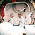
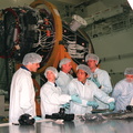
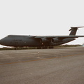
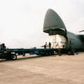
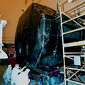
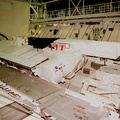
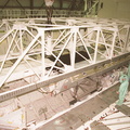
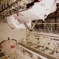
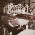
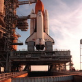
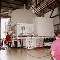
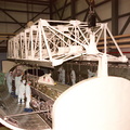
 inside in Orbiter Processing Facility (OPF) bay 2. The primary payload on STS-99, the SRTM will soon be lifted out of the canister and installed into the payload bay of the orbiter Endeavour. The SRTM consists of a specially modified radar system that will gather data for the most accurate and complete topographic map of the Earth's surface that has ever been assembled. SRTM will make use of radar interferometry, wherein two radar images are taken from slightly different locations. Differences between these images allow for the calculation of surface elevation. The SRTM hardware includes one radar antenna in the Shuttle payload bay and a second radar antenna attached to the end of a mast extended 60 meters (195 feet) from the shuttle. STS-99 is scheduled to launch Sept. 16 at 8:47 a.m. from Launch Pad 39A.")
WIKIARCHIVES.SPACE
The Human Spaceflight Archive


Information
- Taken in
- Kennedy Space Center
- Author
- NASA
- Description
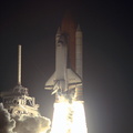
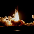
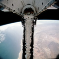
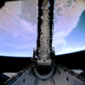
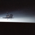
- A crane is lowered over the payload canister with the Shuttle Radar Topography Mission (SRTM) inside in Orbiter Processing Facility (OPF) bay 2. The primary payload on STS-99, the SRTM will soon be lifted out of the canister and installed into the payload bay of the orbiter Endeavour. The SRTM consists of a specially modified radar system that will gather data for the most accurate and complete topographic map of the Earth's surface that has ever been assembled. SRTM will make use of radar interferometry, wherein two radar images are taken from slightly different locations. Differences between these images allow for the calculation of surface elevation. The SRTM hardware includes one radar antenna in the Shuttle payload bay and a second radar antenna attached to the end of a mast extended 60 meters (195 feet) from the shuttle. STS-99 is scheduled to launch Sept. 16 at 8:47 a.m. from Launch Pad 39A.
- Created on
- Wednesday 21 July 1999
- Albums
-
Locations / OSM-4.915832801313164
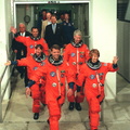
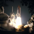
US SPACE PROGRAM / SPACE SHUTTLE / MISSIONS / STS-99 / Rocket preparation
- Source link
- https://science.ksc.nasa.gov/gallery/photos/1999/
- Visits
- 67
- Rating score
- no rate
- Rate this photo
- License
- CC BY-NC-ND
- Modified by WikiArchives
- No (original)
- Downloads
- 0
Powered by Piwigo