WIKIARCHIVES.SPACE
The Human Spaceflight Archive

Information
- Taken in
- Space
- Author
- NASA
- Description
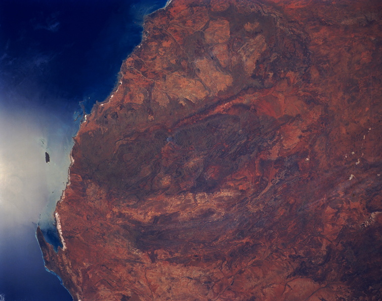
- The entire Hamersley Range is visible in this synoptic view of northwestern Australia. This folded range of mountains (seen as a darker green-brown area in the center of the image) trends generally east-west and is bounded north and south by two river valleys (somewhat linear, lighter colored areas). The Fortescue River is the relatively narrow valley north of the mountains and the broader valley south of the mountains is the Ashburton River. The Hamersley Range has peaks that reach 4000 feet (1200 meters) above sea level. A series of curving, lower mountains, that parallel the Hamersley can also be seen south of the Ashburton River. The Hamersley area is a major source of iron formations and the area north of the Hamersley contain some of the oldest rocks in the world, dating back 3.5 billion years. The lighter color areas north of the Hamersley, known as the Pilbara District, contains huge granite plutons. The small bay (lower left) in the corner of the image is Exmouth Gulf.
- Created on
- Albums
- US SPACE PROGRAM / SPACE SHUTTLE / MISSIONS / STS-31 / Mission Photos (Original) / Earth Observation
- Source link
- https://www.flickr.com/photos/nasa2explore/9401971142/in/album-72157634855353003/
- Visits
- 40
- Rating score
- no rate
- Rate this photo
- License
- CC BY-NC
- Modified by WikiArchives
- No (original)
- Downloads
- 1
Powered by Piwigo