WIKIARCHIVES.SPACE
The Human Spaceflight Archive

Information
- Taken in
- Space
- 작성자
- NASA
- Description
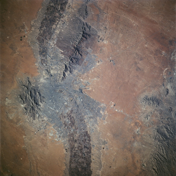
- A nearly vertical view of the El Paso-Juarez area, as photographed by one of the STS-108 astronauts aboard the Space Shuttle Endeavour, flying some 207 nautical miles (383 kilometers) above Earth on December 14, 2001. Center point coordinates of the area pictured are 29.6 degrees north latitude and 108.1 degrees west longitude. The Rio Grande can be seen meandering through the area, forming the borders for two cities (El Paso and Juarez), two states (Texas and Chihuahua) and two countries (U.S.A. and Mexico).
- 생성일
- 금요일 14 12월 2001
- Source link
- https://www.flickr.com/photos/nasa2explore/9354607530/in/album-72157634770086552/
- 방문자
- 36
- 평점
- 평점 없음
- 이 사진 평가
- License
- CC BY-NC
- Modified by WikiArchives
- No (original)
- 다운로드
- 0
Powered by Piwigo